Understanding animals through their behaviour
Understanding animals through their behaviour

Exmoor is a place of moors, mist, rain, red deer, Exmoor ponies, prehistoric barrows and standing stones in miniature. Antiquarian John Aubrey called it “a wrily and barren ground termed Exmoor.wherein there are seen certain monuments of antique work, viz stones pitched in order, some triangle-wise, others in a circle; and one among the rest with an inscription in Saxon letters or rather Danish, to direct those as it seem who were to travel that way…”
Mesolithic hunters came to Exmoor, built temporary structures, and made tools from flint found on the beaches. These have been discovered at Hawkcombe Head by archeologist Paula Gardiner. The clay floor of a hut was also found and some post holes and a hearth. An early mesolithi mace head, a perforated disc, with pebble tools were also found. Nothing now is visible.
Neolithic people settled in small houses and left visible tiny stone monuments. There are two stone circles, an inscribed stone, several stone rows and many three, four or five stone settings. Most of these are so tiny that it is difficult to find them under the heather or in the rushes. These are being eroded the practice of shepherding by vehicle. Click on the photos to see a larger version. (They are available larger from me – use the contact form on my other website, www.celiahaddon.com)
“Exmoor’s standing stones are so enigmatic,” said Rob Wilson-North the park archaeologist. “There are no common alignments. Some settings are North-South; others are East-West.” The standing stones themselves are probably late Neolithic or early Bronze Age. It is also not always easy to distinguish between stone rows and boundaries to Bronze Age fields. More of these tiny stone monuments are still being discovered – see my discovery at Warcombe Water. In addition to the prehistoric stones there are the boundary stones defining the old Forest before it was enclosed. These are mentioned in seventeeth century documents and many are probably medieval in origin. Some of them may have originated as prehistoric standing stones. Many were built into hedge banks and are no longer visible.
For an account of the forest boundaries read History of the Forest of Exmoor by Edward T. MacDermot (Barnicott and Pearce, 1911). For an account of prehistoric Exmoor read The Field Archaeology of Exmoor by Hazel Riley and Robert Wilson-North (English Heritage 2001). I have listed the stones alphabetically according to the latter book and also taken their map references. Thus there may be slight differences from the Exmoor National Park Historic Environment Record (ENPHER), which can be found here. I am in the process of putting the ENPHER number on each stone monument. If you are lucky you may find two more delightful booklets in one of Exmoor’s second hand bookshops – Ancient Exmoor by Hazel Eardley-Wilmot (Exmoor Press 1983) and Antiquary’s Exmoor by Charles Whybrow (Exmoor Press 1970). A good booklet about excavations in the Porlock area can be downloaded here. For those who want a walk on the wild side of Exmoor with the help of a guide I can recommend Richard Medland, an Exmoor walk guide. He is good at finding the smaller stone settings and fun to be with. These are the stones I have so far visited.
 In 1920s this was interpreted as two concentric ellipses with an inner circle of four remaining stones. But in l939 it was reinterpreted as a rectilinear stone setting, maybe two or three parallel stone rows. The stones are small. It is sited on a hillside looking down to Chetsford water just off the Macmillan way. There are 15 stones, three with a stone nearby which may be fallen portion. Remains of a nearby hut circle suggest that the hut, at least, was in woodland.
Single stone, with one large fallen stone at the side. A fallen trigger stone or part of a setting. Western of two standing stones. ENPHER record: MDE 9891 Riley and Wilson North give a map reading of SS 7859 4464.
Eastern of the two stones, apparently paired with the single stone above, though I see no great evidence that these are a pair rather than two single standing stones of similar height. In Riley and North the map reference is SS 7877 4466. ENPHER record: MDE 9890.
 Two aligned stones (with a third stone not visible) when we visited in 2017. The pair point down to the stream in the valley. ENPHER record: MDE 1267. This site was originally reported in the 1960s as a stone circle and what remains may be part of what was once more elaborate stone setting. Identification is made more difficult because there is a scatter of natural loose and earthfast stones in the area.
 Once there were five stones here, a quidnunx, – four in a square with one in the middle. Now only three remain looking like a row, so the setting has lost its pattern, and thereby its original meaning. In November 2001 local archaeologists re-erected the middle stone and put down organic matting round it. They covered it and the others with thorn bushes, in the hope of preventing damage from off track vehicles and rubbing sheep. Details can be found in A Condition Survey of Standing Stones in Exmoor National Park Authority Owned Land, by Oliver Blackmore, a report by Exmoor National Park. By the time I visited in April 2003, the hawthorn was missing from highest stone. Shepherding by Landrover is a danger to these small stones.
 This stone, not unlike the Edgerley forest boundary stone, abuts the forest wall. It stands in the bank on the road that leads from the White Ladder across Kinsford Gate to Sandyway. This is the county boundary as well as the old forest boundary. This ran from the Saddle stone, past the Edgerley stone, Lewcombe stone, Horsehead stone, Buttery stone and to the lost Longstone at Sandyway. Possibly it was a prehistoric standing stone used as a medieval marker. It stands looking down the valley into a stream, as many prehistoric stones do. Not marked on the Explorer map.
 The inscription reads “CARAACI NEPUS’, kinsman of Caractus. The stone originally lay close to a track running out of the Exe valley. A shelter was built for it in l906. Caractus was the British leader of the rebellion against the Romans in 47-51 AD. The stone was first documented in 1219 as a Forest boundary and called the “Langeston”. A little stone hut has been built round it! There seems a modern impulse somehow to domesticate standing stones, to impose our suburban mind set upon their wildness. The practice of siting a Romano-British memorial stone, along a track way up on the hill is a Roman one – think of the tombs along the Appian Way.
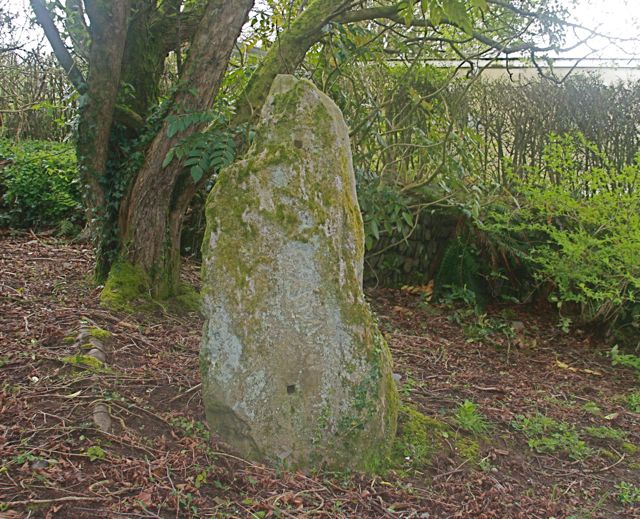 No longer at its original site, but in a private garden near Linton. The inscripton CAVVDI FILIUS CIVILI means Cavudus son of Civilis and the style of the lettering suggests about 500 AD. It was originally near Parracombe, possibly on the road to Lynton, not unlike the Caractus stone. Cavudus is said to be the Romano-British version of St Cewydd,the son of a Pictish kingwho became a monk in South Wales. It has been used as a gatepost.
 This is a fairly wild bit of the Chains and I would never have found them but for the help of Exmoor guide, Richard Medland. Two of the larger stones are in the photo, half hidden by rushes. They look out into The Chains valley. There were originally 13 with 8 still surviving. I didn’t find as many as these. ENPHER number MSO6834. Parking at Prayway Head layby.
 Five stones, a quincunx, – four in a rectangle, and one in the centre with an erosion hollow, overlooking Radworthy and the source of the Bray river. The centre was the only one standing upright in July 2004 when we visited with the National Park archaeologist. Three others were snapped off, fallen or broken – probably the result of four track vehicles on the moor. One was either missing or not visible. Once described as “particularly fine” this setting is now severely damaged. One stone was no longer visible. Time for more active protection?
 This is difficult to find, not least because the stones are small. When I found it with the help of Exmoor Guide Richard Medland the stones we found were not quite at the map references given here but perhaps we only found one end. The other possibility is that we found Cheriton Ridge setting, not the row.
 Easier to find, along the track that leads from Brendon Two gates across Clannon Ball to Cheriton Ridge before it joins the Taka trail. A setting of about six stones. One of them has been given some support by archeologists.

From Brendon Two Gates follow the track and cross Farley Water. Then walk back across the ridge in the direction of the Exe plain. This is a lovely setting of seven stones looking down into the head of Farley Water.
 Not far from Brendon Two Gates (good parking) this is another stone setting that looks down into a valley. This is a triangular setting though my photo only shows two of the stones. These stones look more secure than some of the Exmoor settings. I visited in April when the bog pools on top of the hills (not the streams in the valley) were full of tadpoles. Exmoor must be frog heaven.
 This is a confusing site which needs the landowner’s permission to enter. The map reference is from The Field Archeology of Exmoor, but slightly different map references are given by Hazel Riley’s Hoar Moor & Codsend Moors Exford and Cutcombe, Somerset Research Dept Report Series no 15-2009 and by ENPHER which numbers this as MSO9189 and gives the map reference as SS 8829 4114. It is best understood by the visitor as two different sites. One nearest the hedge near the gate is possible a stone row or even the remains of a double stone row. The other at the other top end of the same field is a setting of three stones. These may be outliers to the possible stone rows, ie part of the same ceremonial site.
  There is quite a lot of free stone lying around so that identifying erected stones can be difficult. However, they are marked on the ordinance survey map which helps. My photographs became a little muddled but I think that the top left photo is one of the three outlying standing stones. The lower left is also one of the three stones and the right photo is one from the stone row. However, I am not completely sure!
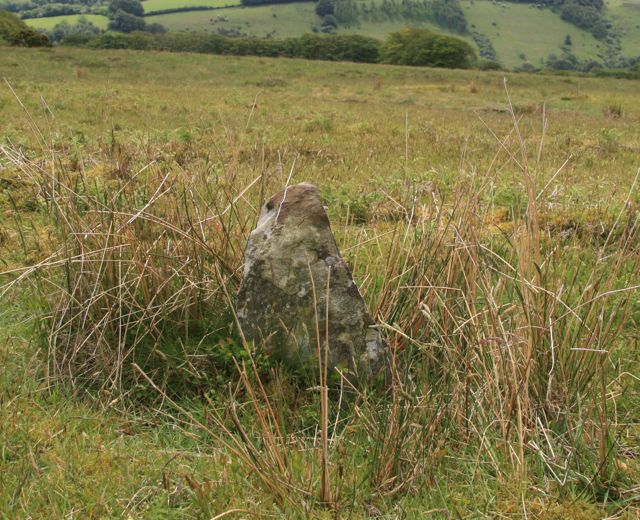
 Discovered in 1939 then rediscovered in 1940. It is inscribed with a wheel cross, of a kind found in Wales. A beautiful stone in a lovely woodland setting. The permissive path has now been closed so it is on private land with no official access. Nearby is the smallest medieval church in England dedicated to St Culbone, a corruption of Kil Bueno meaning “the church of St Bueno,” a Welsh saint. (This not the first connection between standing stones and St Bueno. There is a St Beuno’s Stone, where the saint is meant to have preached, in the parish of St Berriew where the church is dedicated to him.) As there is a stone row nearby it may originally have been the head of the row, the Christianisation of a prehistoric sacred site.

 This runs through the wood from the Culborne stone, with its Christian cross, across the drive to XX farm. Some argue that the Culborne stone itself may simply have been its final or first stone. The row, which is on private land, is difficult to see from the Culborne stone but the end stones, the other side of the farm drive are visible from a gate. The photo on the left was taken some time ago. Thanks to fallen trees this part of the stone row was not easily visible in 2013.
This sta nds in the bank along the county border, a relatively big stone that marks the boundary. It may also been an earlier prehistoric standing stone. The Simonsbath-Challacombe road is a busy one with nowhere to park, so it is best to approach it along the Tarka trail from the so-called Sloley stone at SS 717393. Along the route there is Lew combe boundary stone – a small inscribed stone at SS 717395. This is one of the Exmoor forest boundary stones shown in a map of c 1675.
 A stone setting of which I only found two relatively large and visible stones, both noticeable above the grass. The OS map simple says “stones” without giving details of the pattern. There was one at SS 73395 4488 fallen on its side. There are many loose stones, as well as erected ones, on this bit of common.
 A blue much polished stone part of a setting on this bit of common. There are so many settings on Furzehill common that it is difficult to be sure of which one you are looking at! It is possible that I have mis-attributed this one.
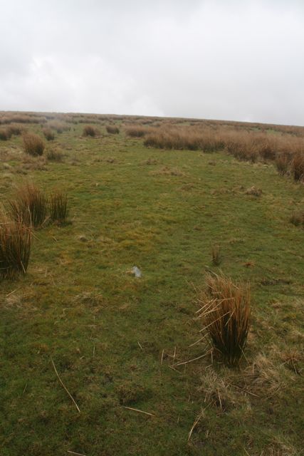
 This is a row of what was thought to be just four stones on the crest of the common – these four marked on the OS map. Because of the grass, they are difficult to find. Then in 2001 six more really small stones were found, leading up to a mound which is5 probably a cairn. This is a good example of how these tiny stone monuments can be missed – hidden by heather or grass for thousands of years. My picture, taken in autumn, shows only one of the stones.
 This is on land belonging to Stone Farm, where my father used to live. The photo makes it look bigger than it is! I think this is ENPHER number MSO6720 though I am not sure!
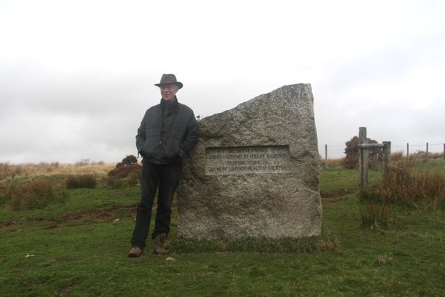 More information from Hazel Riley’s Hoar Moor & Codsend Moors Exford and Cutcombe, Somerset Research Dept Report Series no 15-2009. This one is pictured in that report and described as chisel topped. The ENPHER list mentions a further standing stone, a boundary stone, at SS 8668 4013 Hazel Riley says it stands on the Exford Cutcombe parish boundary, and is part of a prehistoric field system. This is not far from the memorial stone of my father, here on the right with my brother Merlin.
 This is the second standing stone (the top photo) on Hoar Moor mentioned in Hazel Riley’s Hoar Moor & Codsend Moors Exford and Cutcombe. This is ENPHER MSO6721, described as eight stones some doubtful, some more likely to be prehistoric. The listing describes a possible setting of 8 stones and says this stone in the top photo, one other stone and another stone further down the hill at SS 85821 408651 ar
 e the definite standing stones. The others between these two, many recumbent, are more doubtful. The drainage ditch dug across the hill has brought up several stones. The standing stone sites on Hoar Moor are difficult to find among the rushes and the ENPHER listings sometimes differ in map references. All rather confusing!
 About half an hour’s walk along the track from Brendon Two Gates where there is good parking. Another stone setting looking down into the water below. These are set where the slope forms a little platform above the water. Four stones in a kind of rectangle, like the four stones (one fallen) higher up the hill at Hoccombe Hill II. It is really a four stone setting, but one has fallen.
 A triangle of three medium stones looking out over the valley. This is labelled Hoccombe Hill 11 in The Field Archeology of Exmoor by Hazel Riley and Robert Wilson-North. There’s easy parking at Brendon Two Gates. This isn’t as big as photos look, but it is big enough to be visible – unlike some Exmoor stone settings which are hidden in heather.
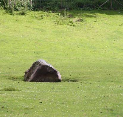 Probably not a standing stone but just a glacial erratic. It has its own folklore. Said to run down to the stream for a drink at midnight. It shouldn’t really be here, but I quite like folkloric stones.
 This is one of the larger stone settings on Exmoor. “Exmoor’s Stonehenge” said Richard Medland joking. For all that, it is quite impressive. Some of the
 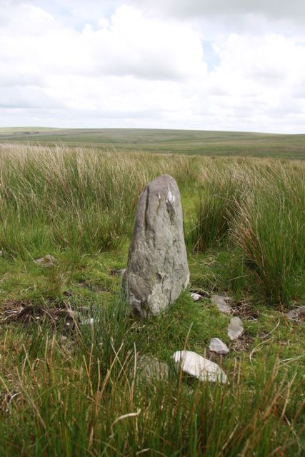 uprights are quite large (see right hand photo), and there are about nine stones that I could see. ENPHER (no MSO6948) reports that there are 13 stones, two of them marked with initials, TD. These initials may refer to a landowning family, Thomas Darch. As I did not look for initials on any of the stones, I did not find any!
 Along from t
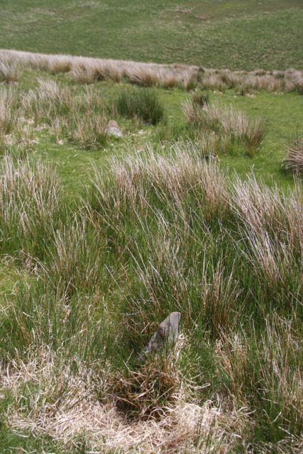 he previous setting is a smaller one. English Heritage report that there are five stones here. The ENPHER number is MSO6947. The site was excavated a few years ago and one of the fallen stones put back into its socket. Like almost all stone settings on Exmoor it seems to be orientated towards the stream in the valley. The left hand photo shows two of the stones, the far one having a pink top to it: the right hand one a third. It seems likely to me that the shape and colour of the stones were chosen with care. For archeological investigations look here.
 Another somewhat confusing stone setting for the visitor. First identified as having five stones, two of them fallen: then a few years later a few more were found nearby if I understand ENPHER (no MSO6949) correctly. There are intials on some of the stones (I did not find them but I did not look for them). Unlike Lanacombe 11 these are not identified as belonging to landowners, being attributed to the military who were stationed on Brendon Common during World War 11.
 One of the forest boundary stones, north of Moles chamber and not far off an eighteenth century monument, called the Sloley stone on the Explorer maps. It was also known as the longstone (despite its shape) or hore stone according to Ancient Exmoor by Hazel Eardley-Wilmot. This stone marks the county border and the old forest boundary. This ran from the Saddle stone, past the Edgerley stone, Lewcombe stone, Horsehead stone, Buttery stone and the lost Longstone at Sandyway. This small squat stone has “Fortescue’ inscribed upon it, the surname of the family that once owned a great area of the forest. It stands looking down the valley into a stream, as many prehistoric stones do, so might be older than medieval. Marked as boundary stone on the Explorer map.
 Really small stones and very difficult to find (again with the help of Richard Medland). Overlooking the sheepfold near the fords where Hoaroak Water runs into the Chains Valley Water. They are small, overgrown by grass and rushes and almost impossible to photograph. My photo shows one of the more visible ones. The setting has three stones. There are others around which are merely natural. ENPHER number MSO12249 Parking at Prayway Head layby.
 These are to be found on a spur overlooking Hoaroak Water. They looked like just two paired stones (one in the foreground, and one much higher up in the photo) but The Field Guide to Exmoor says they are a setting even though the Explorer map shows only two. ENPHER number MSO6962 Parking at Prayway Head layby. To see them in my photo click on it.

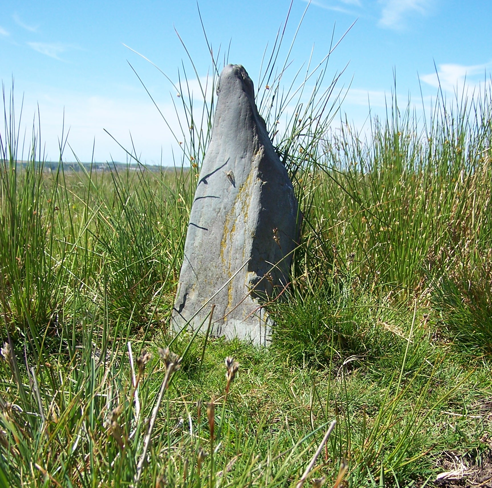
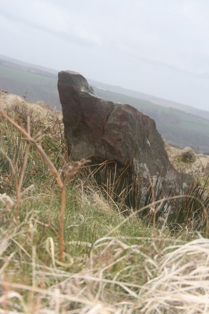
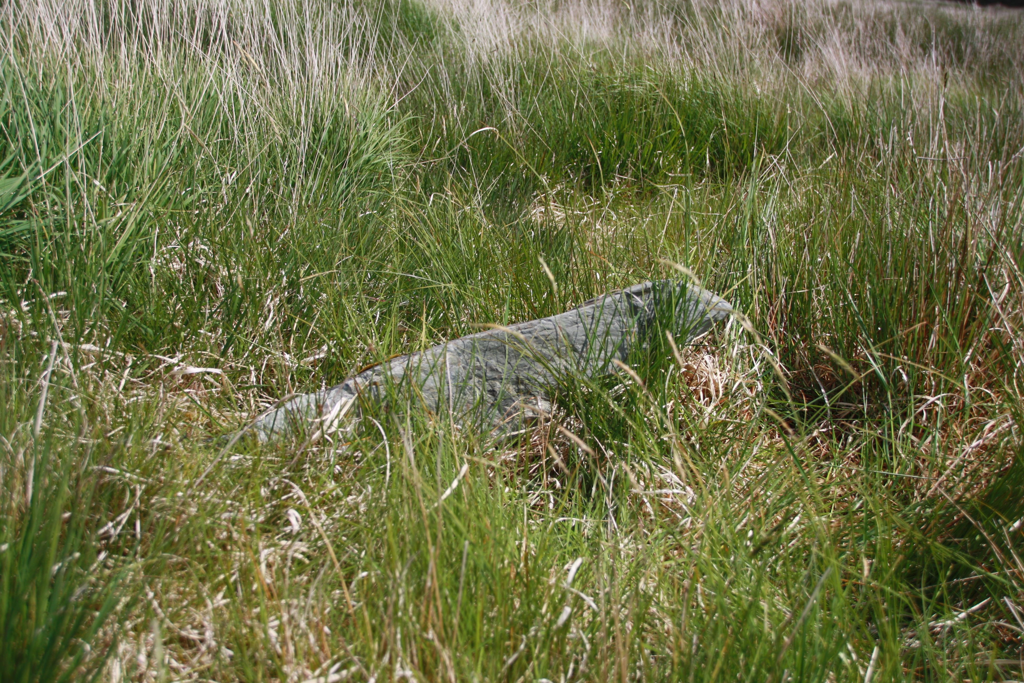
 This is the most spectacular of Exmoor’s standing stones seen with Longstone barrow behind it. It is three meters high but made of a very thin slab of slate, with a trig stone (for keeping the stone upright) next to it, as the picture looking west into the Bray valley shows. The stone used to stand in a picturesque water-filled hollow making it vulnerable to frost damage. A natural spring nearby didn’t help. It was “consolidated” by archaeologists in 2003 using 3 tons of river washed gravel, erosion matting and a covering of peat. In the course of this remedial work, which was not an excavation, they found a bit of a car engine and three pound coins!
This is 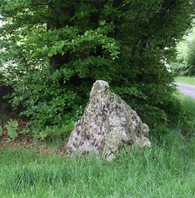 not on Exmoor forest but on the Brendon Hills just off the road B3224 from Taunton at Smithhayes. Easy to find and marked as a boundary stone on the map. This is yet another standing stone that is said to go down to the nearby stream to drink at midnight, according to Ancient Exmoor by Hazel Eardly-Wilmot, a useful booklet by the Exmoor Press now out of print. It is not far from Dun’s Stone at Middleton Lodge, which English Heritage says it not a standing stone but a natural outcrop.
 An elaborate stone setting with 15 visible small stones, off the Lynmouth-Simonsbath road.. It is almost impossible to photograph as a whole except from the air not is it easy to see a pattern in the arrangement of stones. Once again, this is a stone setting on the hillside below the ridge, looking down to Farley Water.

 A tiny setting of only three stones, all small, close to the Lynmouth-Simonsbath road. I think I found all three but the recumbent one that I photographed may have been a split off part of the remaining upright. One is a small rounded bluish stones further away from the other two. In the spring of 2003 when I was there the other upright had split into three – probably frost damage. I propped up the fallen two bits to make the photograph and reported it to the National Park authorities.
 Discovered in 1928, there are ten stones or stumps and eleven recumbent stones with a diameter of 24.5 m. The highest stone is nearly three feet but it is not impressive. The circle is next to a sheep pen not far from the head of Weir Water. Difficult to photograph well. You can download a booklet about recent investigations here.
 A pair of stones looking into different valleys on a spur. These could be separate single stones. Difficult to be sure. There is a possible fallen third stone. ENPHER number MSO7911 Click on the photo to see the second stone more clearly.
 I am not sure if I found this or not. It is the other side of the road from the field with the stone circle on the common. There are several stones but the heather was high, so I could only find two of them. This is meant to be a double row. I need to go back and take a further look. There is a booklet about recent investigations to download here.

 Mentioned in the 1651 survey of Exmoor Chase as “along to Sadley stone being abutted on the West by Linton Common.” A seventeenth map of the boundaries has a drawing looking much as it does now. In 1678 it is mentioned as “a certain stone … called sadlerstone, the said stone or boundary last mentioned having something the shape or figure of a saddle.” At the time of the final enclosure, the boundary is described as “passing by Woodburrow to a stone called Saddle Stone, which divides the parish of Challacombe from the Parish of Linton.”
  This is one in the line of boundary stones which started at the lost Sandy Way boundary stone, on past the Horsehead stone, past the relatively modern Sloley stone, past the Lew Combe stone, past the Edgerley stone to the Saddle stone. It was positioned 80 yards below and North of Saddle stone gate, then by l911 went missing according to The History of the Forest of Exmoor by Edward MacDermot. It is now positioned close to the gate. It may have been useful as a mounting block, though it is not very high. The gate itself has a splendid piece of stone used as a gatepost.
 Marked on the Explorer map, this is a recent boundary stone in the shape of a gravestone erected in 1742 to mark the boundary between High Bray and Gratton Manors commons meeting the forest boundary. The facing side is marked “William Longe Oxenham Esquire Lord of the Manor of Highbray 1742”. The opposite side says “Christian Slowley Lady of the Manor of Gratton.”
 Six standing stones (one fallen with what is probably its fallen trigger stone) in a rectangle. Or possible two matching rows of three stones. This is difficult to tell. There is apparently a stump of a seventh stone which I did not see. So it might be a different shape altogether. About an hour and a half’s walk from Alderman’s Barrow. ENPHER number MSO7750.

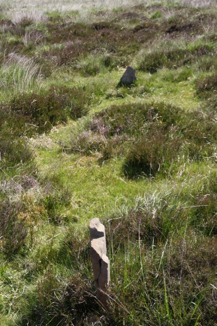
 In June 2006, walking with Richard Medland, Exmoor’s walking guide, I looked up from the valley between below Ruckham Combe and Warcombe Water and saw a small triangular stone on the spur of the hill at SS 7287 4424. There were four in a line (one fallen) then a gap (which may have been a track), a further two at SS 7289 4423, then another gap and one more at SS 7291 4422. In all seven stones, embedded, not loose, on a relatively stone-free hillside. They were only visible because the heather had been burned. In September I came back with the national parks archeologists Rob Wilson-North and Stephanie Knight, Richard Medland. They inspected the row and thought it was either a stone row or possibly a prehistoric field boundary – there was a bronze age settlement not far away. Then I spotted some more stones at SS 7285 4425, and a final one at SS 7282 4427 going further along the contour. The row seemed to run towards a spur of the hill looking down into the water that runs down from Ruckham Combe. The row was longer than I had thought and was between nine to 11 stones (a couple being so buried it is not clear if they counted). English Heritage counted 9 upright and three prone stones. After further inspection, English Heritage has authenticated this as a stone row. Details can be found in Lithic Monuments on Exmoor: Some New Discoveries. The Warcombe Water Stone Row and a Stone Setting on Trout Hill, by Hazel Riley, Research Dept Report Series 44-2007. NOTE. If you find this discovery attributed to somebody else, tell me. There’s a guy keeps ripping off my website!
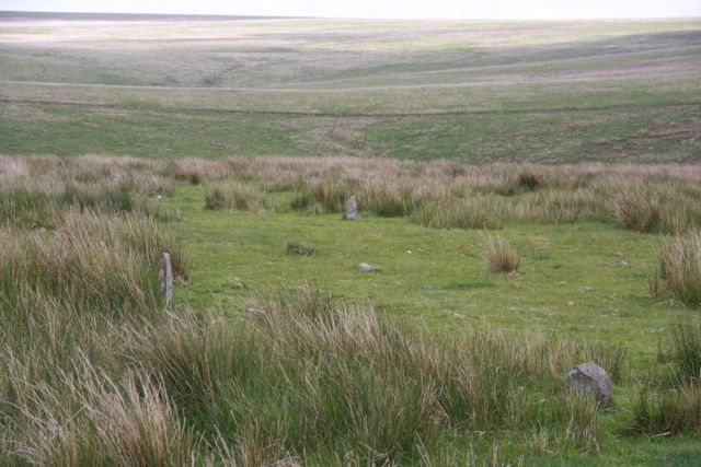
 The heather had been burnt in spring 2003 so the circle stood in blackened earth. If the heather had been high I might not have found it at all. It is on the hillside down from the barrow overlooking West Water and the hills opposite. One way to find it is to walk up to Withypool hill tumulus, line up Tudball Splats on the opposite slope and walk towards these. There is a track through the heather. Discovered in 1898 when 37 stones were counted. Then in l915 when they were recounted as 40 stones. Diameter is 36m. No stone is more than two feet high and most are much, much smaller. I counted 40 stones (excluding those placed in the centre of the circle, but some were so loose I am not sure if I counted the right 40!
 They are on the boundary of the medieval forest. It is not clear if they are standing stones or merely natural outcrops. They have been suburbanised by the planting of daffodils!
 Not too difficult to find as it is quite near the road, but it’s impossible to photograph the row itself unless the heather and grass has been burned lately. One of nine stone rows on Exmoor – one at Warcombe Water found by me. There are five stones, according to the Explorer map. ENPHER number MSO7360 But said to be up to 51 stones with some of the row being a double row on the National Park records.

 This is a long stone row, double and single rows running for a quarter of a mile but the stones are so small that they are only seen when the grass is unusually short. Of 161 stones, 61 were quartz. I found a largish stone quartz but it looked like an outcrop rather than one of the stones. I could only find one of the small stones but I did not wish to hunt too roughly in case I disturbed them. The grass was long – probably a good way to protect a potentially very fragile monument. The row is not continuous since some were in a field that was ploughed and the road interfered with some. A small rather grubby notice warns against moving stones
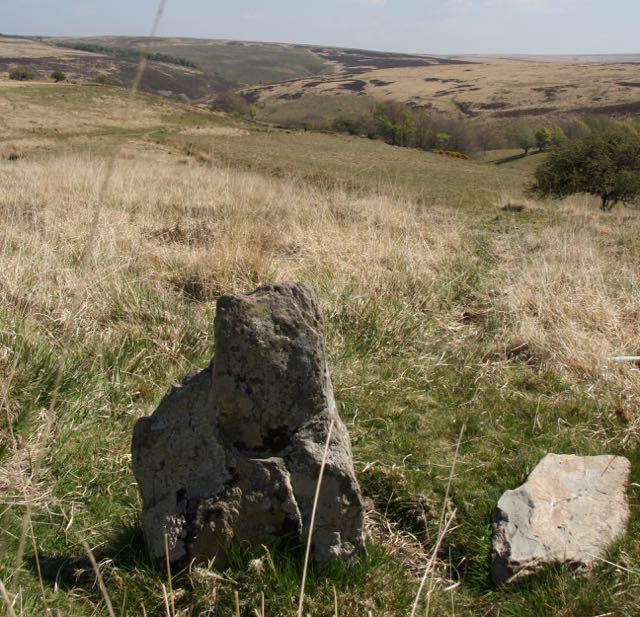
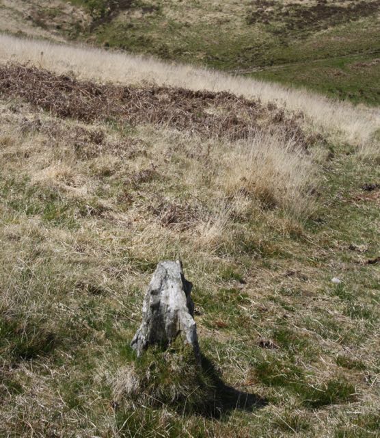
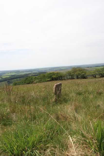
 A small slender standing stone, 1.30m high, below the horizon but looking out across the valley. The most beautiful setting of all the stones I visited. In the sunlight I could see a buzzard and hear a raven. It was perfect peace.
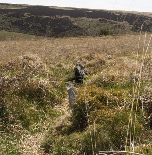
 Marked on the Explorer map, and in some books, as a double stone row, but described as a setting in “The Field Archaelogy of Exmoor”. The visible stones did not seem to me to be in lines when I visited in 2004. Four were visible but only three would fit into the picture. Like most of the stone settings this one looks down into a valley, Yarbury Combe head.
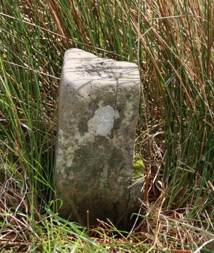
 These are difficult to find being hidden by rushes. They are also positioned a little higher than the Explorer map suggests. I only found three of them, all fallen.