Understanding animals through their behaviour
Understanding animals through their behaviour
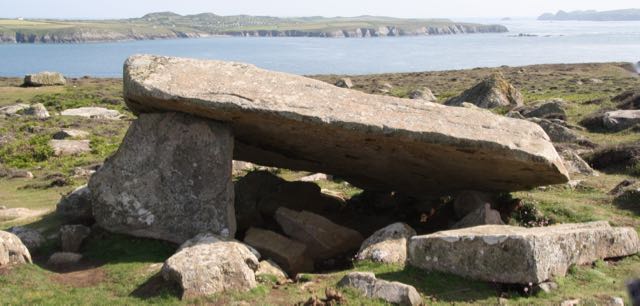
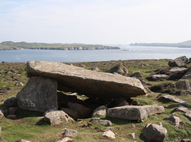
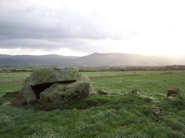
Coetan Arthur St Davids
In November 2005 I went to Pembrokeshire wto look at Neolithic tombs under the guidance of archaeologist George Nash. Throughout Pembrokeshire there are standing stones, some erected in modern times as rubbing stones for cattle or sheep. There are also clusters of tombs – portal dolmens with a single chamber (like the Hoar stone in Enstone, Oxon), double dolmens with two chambers probably later in time, earthfast tombs with one side of the capstone anchored in the earth.
Many of these – perhaps not the earthfast type – had mounds of earth or small rocks over them. The capstone may have protruded from the top of these. Some portal dolmens were incorporated into long mounds with a tail and with forecourts. Though the forecourt “horns” are shaped (though not constructed) like the long barrows of the Cotswold Severn area (like Belas Knapp in Gloucestershire), there are other differences in design.
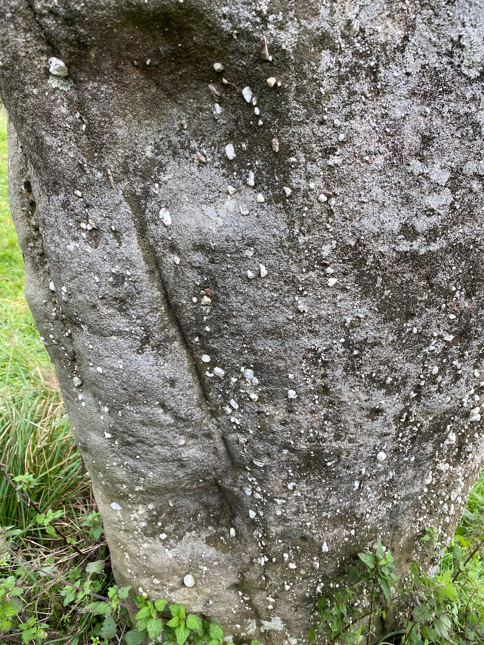
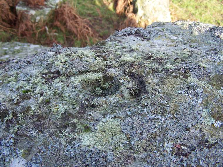
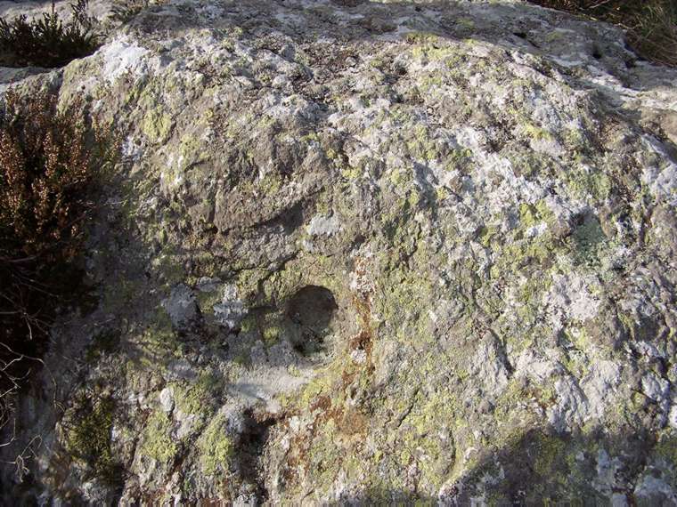
Exact dating is difficult but these are generally ascribed to the Neolithic age. There are few reliable remains to date. Even human bones, which can be dated, may have been placed in the monument later. Cup marks found on the monuments would have been added later in the Bronze age.
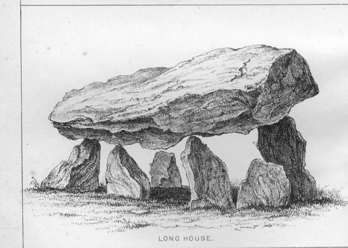
Folklore in Pembrokeshire ascribes these monuments to local saints or King Arthur, rather than the Devil. And the Welsh romantics of the eighteenth and nineteenth century claimed that they were bardic or Druid altars rather than chambered tombs. Many of the early antiquarians could not believe that Neolithic man would have covered up the dolmens, erected with such difficulty, with earthen mounds. The line drawings come from the Archaeologia Cambrensis 1872, unless otherwise stated.
I have followed George Nash in “Neolithic Sites of Cardiganshire, Carmathenshire and Pembrokeshire” (Logaston Press) in grouping these geographically. But within each group I have ranked them in alphabetical not geographical order.
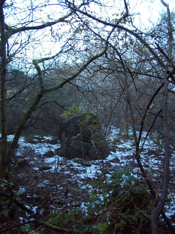
Also called Arthur’stone or Ebernezer, Hidden in bushy woodland, just off a footpath and footbridge over a stream, this is a much damaged site. A amulet discovered nearby may date the monument to the late Neolithic early Bronze age. Probably a portal dolmen with one small chamber, three upright orthostats and a slipped capstone. Archaeologist George Nash detected some stones, which might suggest a passage with a façade.
A row of three large upright standing stones made out of puddingstone, a conglomerate of pebbles stuck together with silica and lion oxides, in the church along the B4293, south of the village. The village itself is named from the stones – tre – three, lech – stone. They were supposedly erected to commemorate a victory by King Harold, but are neolithic. A folklore tradition tells how they were thrown down by a giant, Jack of Kent, from the nearby Sugar Loaf mountain when he was playing quoits with the Devil.
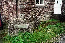
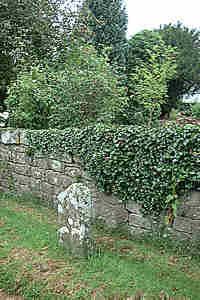
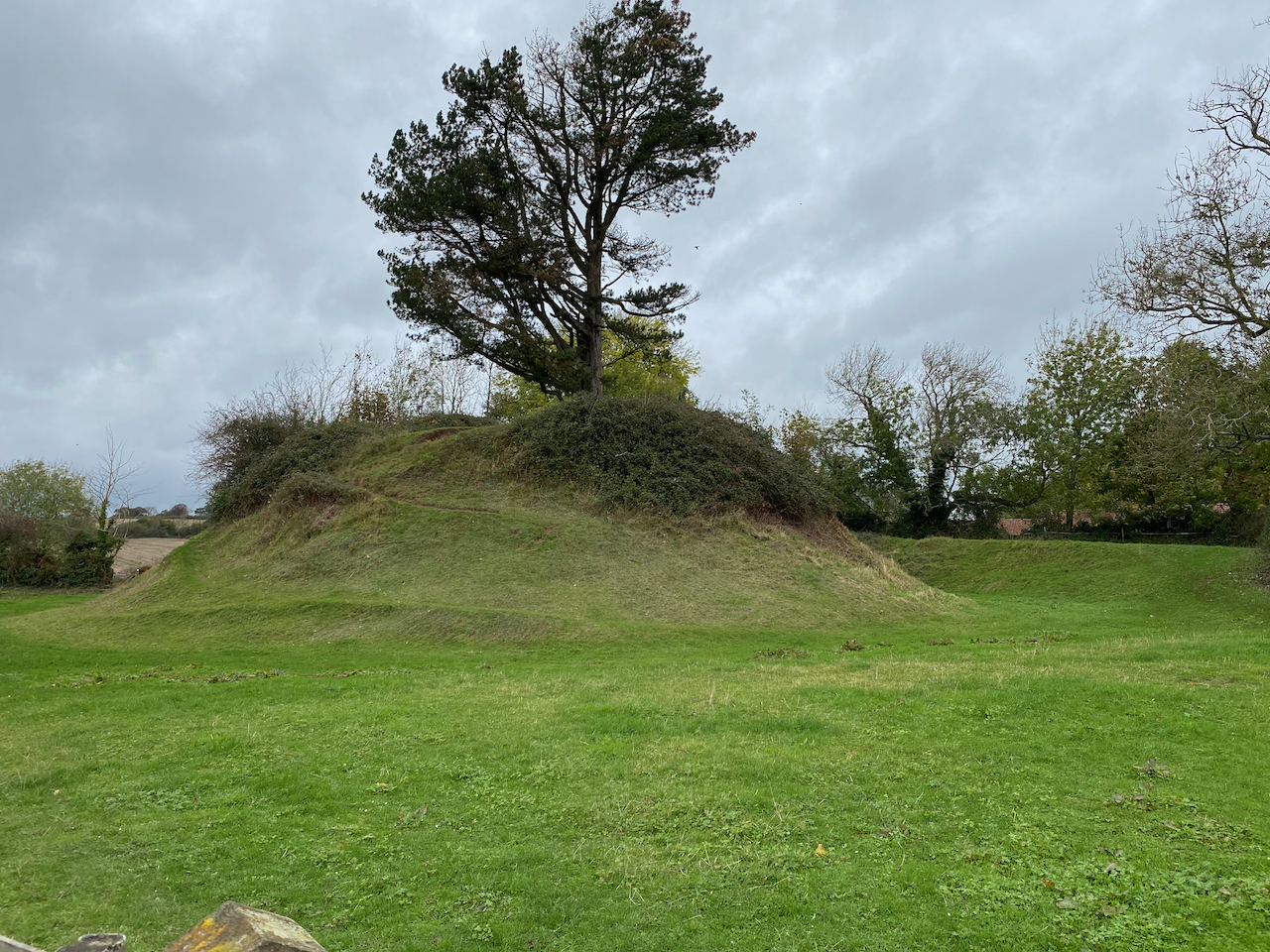
Folklore says that if you pull out one of the small stones from the puddingstone, it grows a new one. If you walk back from Harold’s stones, you come to the little drinking trough which marks the Virtuous Well at the crossroads towards the village. Turn into the village and there is a little waymarker stone in the lane on the right. This is the other side of the garden wall of Hollytree House. On the village “green” (a green without grass) is a mounting block of stone next to an old millstone (I think) – is this the Mounting stone shown on the Explorer OL14 at SO 504102, saved by the Friends of Trellech. There is a mound, all that is left from a Norman motte and bailey. And in the churchyard is a whacking great slab of stone which may be a Saxon altar stone or the top of a tomb, as well as a fine medieval preaching crosscross.

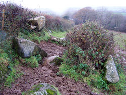
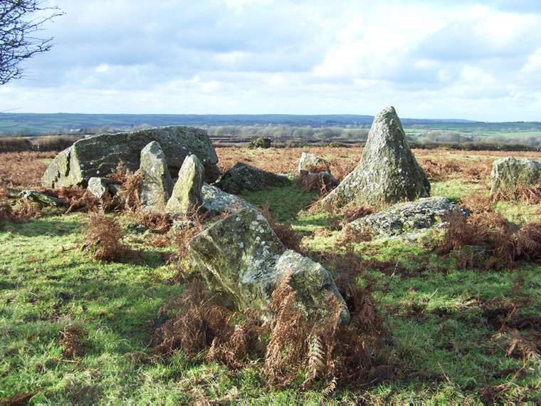
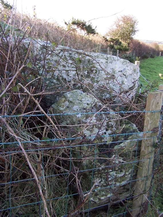
A much damaged chambered tomb. Some of the monument is probably still in the hedge boundary. Archologist George Nah suggests this, Parc yu llyn and Garne Tune may be by late Neolithic, c. 2500 BC. This could do with some wire or fencing round it to reduce cattle damage.
A large capstone on three legs like a tripod which dips towards the Afon Nyfer estuary. Also known as Arthur’s Quoit. The site is railed off(why do people think dolmens need caging?) and surburbanised by nearby bungalows and caged in by railings, as if dolmens were zoo animals! Nash describes is as a classic portal dolmen once incorporated into a long mound. There are still traces of this mound. When leaving the dolmen on the right of the tarmac drive, next to the “Private road” sign, was a small polisher stone. It may now have disappeared, possibly into somebody’s rockery.
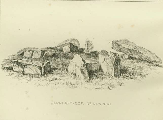
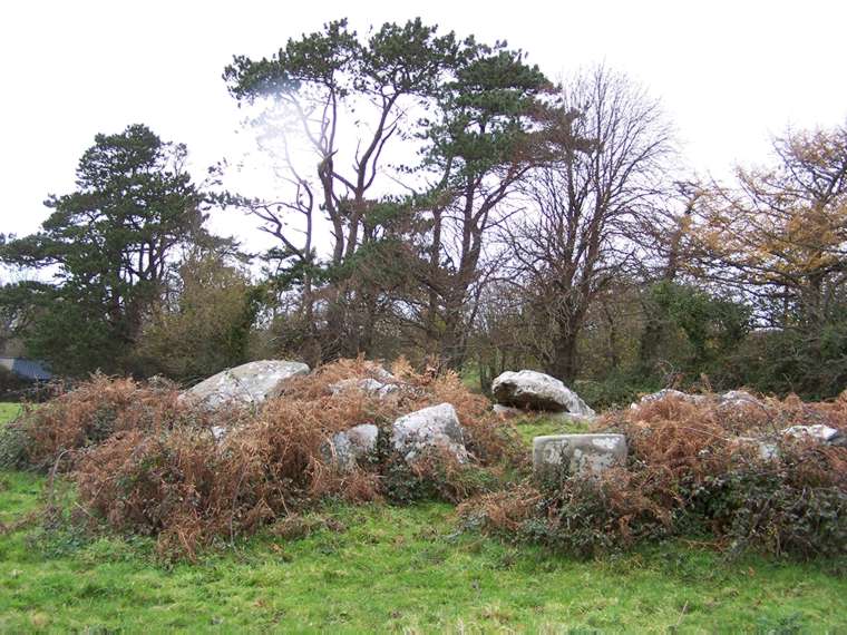
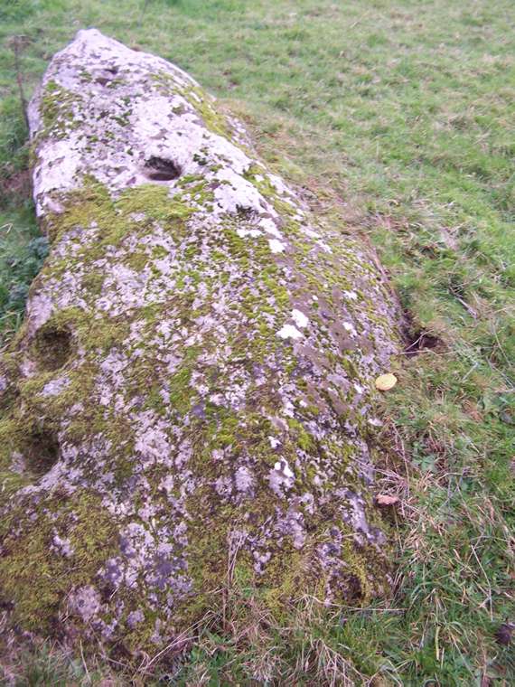
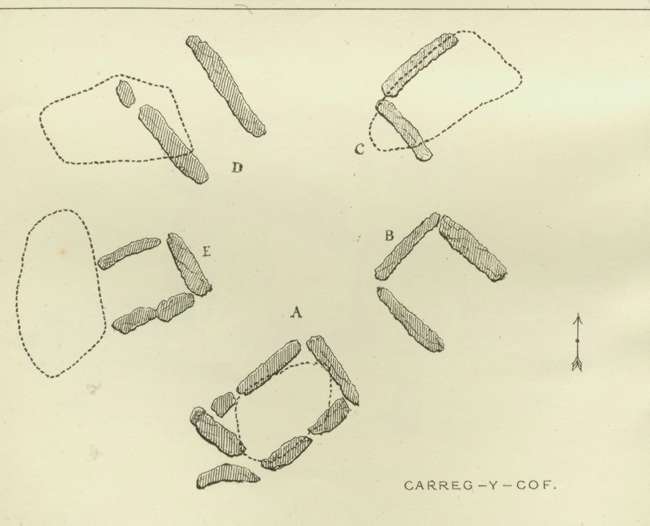
Sir Richard Colt Hoar reported in Journal of a Tour in South Wales. Anno 1793. “In a field between the town and the harbour (of Newport) I saw another druidical relict, resembling in some degree the one at Pentre Evan but infinitely smaller in its proportions. The upper stone resembles an umbrella or mushroom. Though there are several stones underneath, some fallen to the ground and others standing, it rests only upon two. But as it is evident that some have given way it is impossible to say how many it was formerly supported (by).”
There were remains of its earth or stone coverings visible in 1872 according to the Archaeologia Cambrensis of that year – vol 3 Ser.4. p 140.
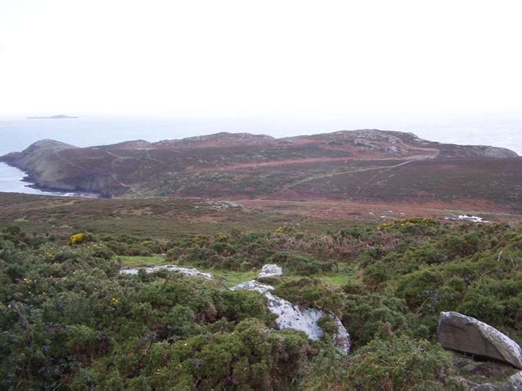
A double chambered tomb looking out towards a Neolithic settlement with field systems still visible. George Nash thinks this was unlikely to have had a covering mound. The west capstone is of the “earthfast” type, with one end resting on the ground. There is a theory that the other capstone once rested on a ledge of rock. This tomb nowadays, and possibly always, merges into the rock hillside so that it is, unlike many monuments, invisible from afar.
A concrete gun emplacement, built during World War 11 just near this tomb, is still visible. On the way back from here to St David’s town various erect stones are visible from the entrance to Emlych farm.
The headland of Carn Llidi excited Sir Richard Cold Hoare to exclaim in Journal of a Tour of south Wales in l793: “No place could ever be more suited to retirement, contemplation or Druidical mysteries, surrounded by inaccessible rock and open to a wide expanse of ocean. Nothing seems wanting but the thick impenetrable groves of oaks which have been thought concomitant to places of Druidical worship and which, from the exposed nature of this situation, would never, I think, have existed here even in former days.”
So called since it was thought that St Samson lifted the capstone with his finger. This was a portal dolmen probably incorporated into a long mound. The outlying stones are just outcrop. Like other portal dolmens, the stones were erected over a pit now filled in. At one stage the monument may have had dry stone walling – possibly because it was used as a sheep shelter.
Excavations in l968 found an early Neolithic bowl.
Of great interest to archaeologists, this tomb has five small burial chambers (cists) radiating out from the centre of an oval mound. George Nash suggests this tomb may show the transition from Neolithic to Bronze Age tomb design. An outlying stone, not necessarily an erected one, at SN 0357 3892 is cupmarked.
We are lucky it still survives. In l853 an antiquarian vicar, the Rev H. Longueville Jones reported: “Five cromlechau arranged like the radii of a circle.. all cleared from the surrounding stones and earth; the tenant is very anxious for their removal, .. the probability, therefore, is that within a few years a new wall will have been added to the field, but that this almost unique monument will have disappeared.”(Arch Cambrensis 4, p 276). By l872 the journal reported that some of the stones had been removed. The l872 plan and line drawings are easier to follow than my more modern photos!
 On the coast near St David’s Head not far from the Carn Llidi tombs. Quite difficult to find. The capstone may have collapsed, as there are two fallen uprights in the chamber. Baring Gloud in 1898 said “there are traces of a passage leading west from the chamber.”
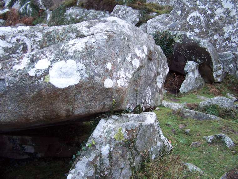
Possibly the largest capstone in Britain. Like Pentre Ifan, this has a forecourt of uprights. The forecourt has a prostrate stone in the middle of it. Nearer the capstone is a fallen stone which may have been the door or blocking stone. The capstone has collapsed off its uprights. A ring cup is clearly
visible on it.
The monument merges into the surrounding rock outcrops and possibly had no covering mound. The surrounding fields have been cleared of boulders so possible nearby Neolithic standing stones are no more. But there are two possible standing stones in the same field. One pointed one at SM 97935 27298
and one flat topped at SM 97904 27307.
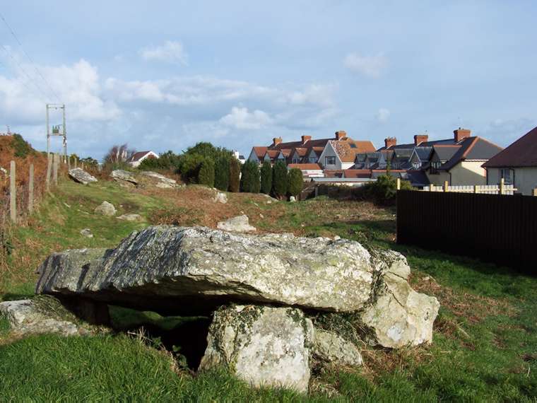
This major prehistoric site, on the headland looking down to Goodwick bay, is living proof that some planning officers don’t give a damn about these monuments. This is an amazing linear cemetery of three, maybe once five, megalithic tombs but a row of seaside houses has been built only a few yards away. The tombs could look out to the sea if it wasn’t for these houses in between! Gardens are now intruding upon this cemetery.
It is difficult to know if these are portal dolmens with slipped capstones or earthfast capstones with one end in the soil. There is no evidence of covering mounds and the tombs blend into the rocky outcrops. Up the hill are natural rocks including a cupmarked one at SM 9482 3904. Easy access by footpath.
The second stone is in the background
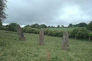
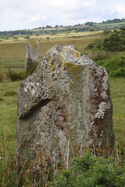
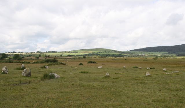 A small stone circle of 16 stones, eight of them spotted dolerite like the famous bluestones of Stonehenge. Nearby are a pair of large standing stones. There is no ditch or bank round the circle and nearby were earlier Mesolithic finds under the bog. The circle is situated below the Preselli mountain. The paired stone nearby are possibly exit or entrance stones and there are 4 other paired stones in the valley
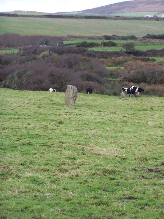
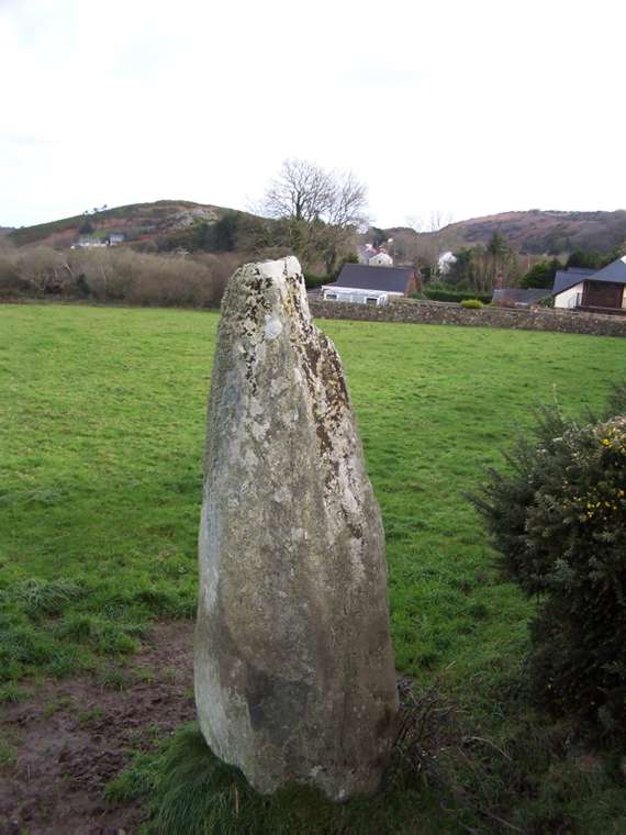 The Lady Stone, Dinas Cross, SM 9958 3764
A single standing stone, railed off the A487 Fishguard to Newport road. A processional marker? Said to resemble a cloaked woman. The name of the Lady may mean Our Lady, a Christianised name for an earlier stone.
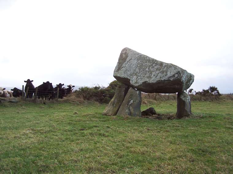
In a field off a rough track towards Penland Farm, this looks like a tripod. A fallen stone may have once been the fourth to hold up the huge capstone, which almost seems too large for its supporting stones. Also known as Samson’s Quoit or the Altar stone.
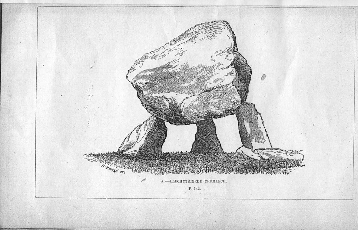
In 1613 in The Description of Pembrokeshire, George Owen of Henllys (1552-1613) reported: “There are other stones in iij or iiij other places in the country adjoining (to Pentre Ifan) as Legh y tribedd near Richardstone and one in Newport near the bridge, another beneath the town but not comparable to this, neither in bigness or in standing so high.” The l872 line drawing is from the opposite angle to my photo.
This has become incorporated into the field bank at the end of a green lane (wired off), which turns to become a footpath. A tempting site for archeologists as the earth banks have probably protected whatever remains in the tomb. The standing stone right in the middle of a nearby field may be linked or it may just be a rubbing stone for cattle. This tomb would have been visible from Carreg Sampson and probably looked like Llech y Dribedd.
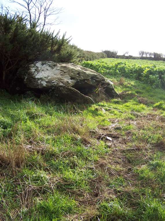
A smaller monument not far from Garn Turne on private land. The collapsed capstone is close to the banked hedge, which may enclose a second chamber. This kind of monument doesn’t look much to outsiders but it offers archaeologists the chance to find unexcavated and unplundered tomb material in the future.
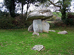
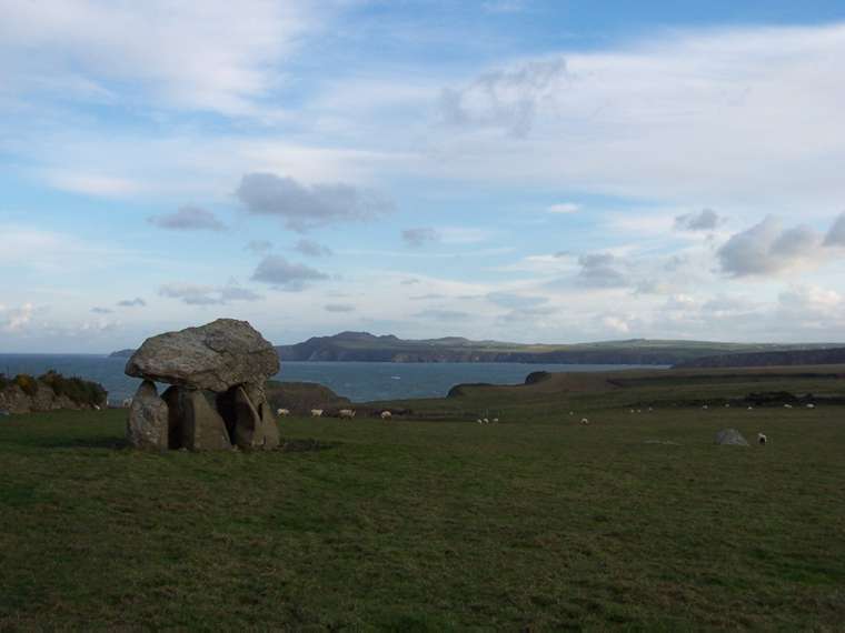
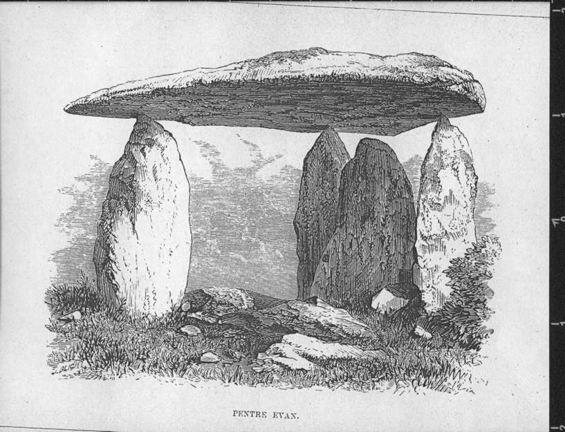
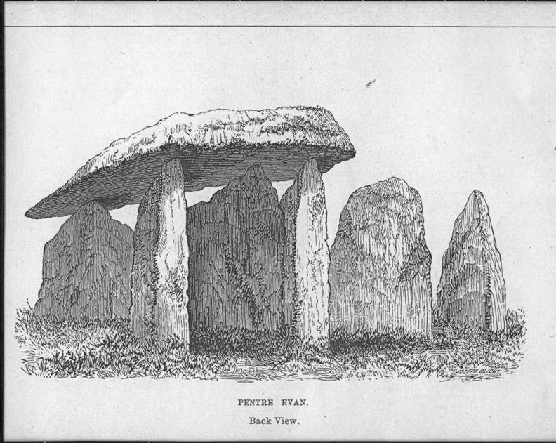
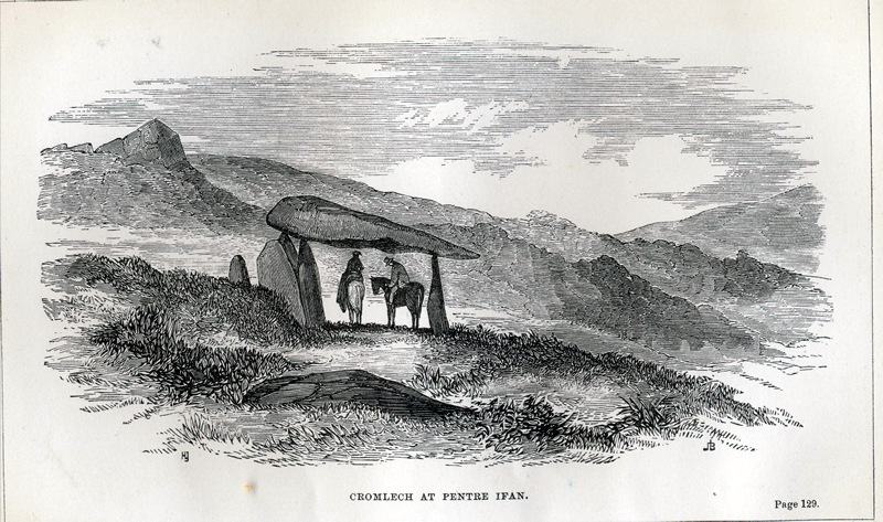
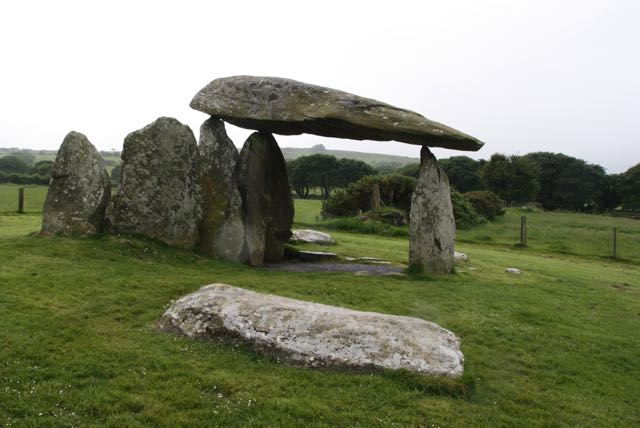 Like Stonehenge in England, this is a Welsh megalithic icon, on the tourist map from the seventeenth century onwards. It is a closed portal tomb with a single burial chamber. Below the capstone, the tomb’s chamber was originally cut into the earth and lined with dry stone walling. This has now been filled in.
Like a Cotswold long barrow (see Belas Knapp Gloucestershire) it had “horns” erected either side of the entrance, making a forecourt area, and a stone in the middle of the entrance, not in contact with the capstone. This acted either to block entrance into or if moved to allow entrance into the tomb’s chamber. It looks rather like Cotswold Severn long barrows to me, but is generally thought to be influenced by Irish Carlingford tombs. This huge monument would have been covered with stones and earth, like a long barrow, though possibly with the large capstone showing at the top. Nineteenth century archaeologists had great difficulty in believing that these monuments were covered by earth or stone cairns.
In 1613 in The Description of Pembrokeshire, George Owen of Henllys (1552-1613) reported: “Another thing worth the noting is the stone called Maen Y gromlegh upon Pentre Jevan land; it is a huge and massie stone mounted on high and set on the tops of iij other high stones, pitched standing upright in the ground, it far passeth for bigness and height Arthur’s stone in the way between Hereford and the Hey… or any other that ever I saw, saving some in Stonehenge upon Salisbury plain…. The stones whereon this is laid, are so high, that a man, on horseback, may well ride under it, without stooping, the stone that is thus mounted is xviij foot long and nine foot broad, and three foot thick at the one end, but thinner at the other, and from it, as it is apparent since his placing there, is broken a piece of 5 foot broad & 10 foot long, lying yet in the place, more than 20 oxen would draw, doubtless this stone was mounted long time feet hence in memory of some great victory, or the burial of some notable person, which was the ancient rite, for that it hath pitched stones standing one against the other, round about, and close to the huge stone, which is mounted high to be seen afar off….but there is no report or memory or other matter to be found of the cause of the erecting of this Trophea, they call the stone Gromlech…”
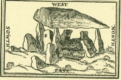
(His drawing shows fallen stones under the capstone that are no longer visible. He mistook one for a large fragment of the capstone.)
John Aubrey mentions Pentre Ifan “called Y Gromlech” in Monumenta Brittanica and, reflecting on the word “cromlech” remarks “that the Irish historians call one of their chief idols Cromcruach.” Early antiquarians often get led astray by place names. Aubrey probably knew of it from Sir Edward Lhuyd (1660-1709) at the Ashmolean in Oxford, who toured Wales, and rewrote the Welsh section of Camden’s
Brittanica in its 1695 edition.
Sir Richard Colt Hoare in Journal of a Tour in South Wales in l793 wrote: “On a rough and stoney common, is a druidical relict, known by the name of Y Cromlech, and by the common people perhaps better by the appellation of King Arthur’s Quoit. It consists of one large stone about eighteen feet long, supported by three others about eight feet high. There are others placed under it but of no use, as the great stone does not rest upon them…In the field adjoining some large stones lying on the ground seem to indicate the
existence of another similar monument of antiquity.”
In the adjoining field are some stones that look like standing stones. A local vicar, with the bardic name of Tegid, in the nineteenth century claimed one of the fallen ones was a bardic alter! People read their own culture into antiquities and no doubt our modern interpretations will seem quaint in a century or two!
A collapsed portal dolmen, possibly a double one – see the diagram in Neolithic Sites of Cardiganshire, Carmarthenshire and Pembrokeshire by George Nash (Logaston Press). It stands on a small mound, perhaps the remains of its once much bigger
covering mound.
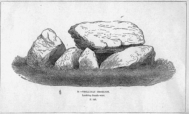
The builders used two kinds of stone and there are cupmarks (disputed) on the capstone. There may once have been dry stone walling between the uprights. The name apparently means Toad’s Hall and a medieval Welsh historian claimed that a chieftain buried inside the tomb had been eaten by toads! No footpath – you need permission from Trellyffant farm to visit this.
Just over the Wales border in Powys. Worth going to see if you are visiting the Michaelchurch Escley sites. Marked as stone circle on the OS map and sited next to a car park on a minor road from Hay-on-Wye to Llanthony. Only one erect stone, about 1.5 m high with smaller stones lying nearby and a few opposite. Underneath an OS mark there’s what is thought to be a cupmark. The ground is uneven so it is difficult, if not impossible, to see how the circle may have gone. There’s a boulder put there by park authorities to stop people driving over the site.
![]()