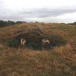
 A small completedly undisturbed long barrow just behind Lodge Park owned by the National Trust. It is signposted off the A40 between Burford and Cheltenham. Take the path into the park behind the house. “This is the finest long barrow I have ever seen; it is certainly the most perfect speciment in Gloucestershire, and should be left exactly as it is and never excavated, in order that posterity may be able to see at least one unmutilated long barrow,” wrote O. G. S. Crawford author of “The Long Barrows of the Cotswolds,” in 1925. The two entrance uprights protrude from the soil covered by a lintel which has tiled backwards. What looks like a round barrow, perhaps a ring ditch one, is nearby. Crawford also detected tops of other large stones flush with the surface and a suggestion of a ditch. Neither were visible to me. His measuresments 180ft by 120ft at the east end, orientation NW-SE. The lintel – 8 ft wide and 1ft 10 inches thick.
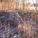 Not far from a footpath, this ruined long barrow in Lamborough Banks covert is securely walled off from plough land. Opened in 1854 and now a ruin, it is still huge 270 ft. It is overgrown with brambles etc but it looks as if the trees growing out of it have been chopped down. There¹s a standing stone at one end perhaps a closing stone. In his l925 “Long Barrows of the Cotswolds,” O.G.S. Crawford says that it was once larger and that bits had been recently chipped off this stone. According to my map there is something described as a “mound” not far also in the same wood.
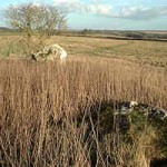 Just outside Cirencester park on the hills overlooking the valley of Duntisbourne Abbots is the remains of a long barrow. At the east end stands the Hoar Stone, with two smaller fallen stones. In the middle of the low mound is another big fallen stone, partly covering a smaller stone. Excavated in l806, the barrow has lost its original shape. The growing corn and over grown site make an autumn or winter visit the best. This is no 14 in Old Stones of the Cotswolds by D.P. Sullivan (Reardon). These may be the hoar stones of which it is said that they run round the field when they hear the nearby church clock strike the hour.
“A few days since a large oblong British or Danish barrow was opened in the parish of Duntisbourne Abbots.. in which was found a kistvaen or cromlech, containing about eight or nine bodies of different ages, many of the bones of which, and the teeth, were entire….. The largest stone which has long been known in the country by the name of the Horse Stone is of the kind of Grey Withers or Stonehenge.. ” Gentleman’s Magazine 1806, part 11, p 971.
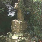 The Jackbarrow long barrow was destroyed in the nineteenth century and most of its stones are probably in the paving of Jackbarrow Farm¹s stables. But, in a graceful acknowledgement of the dead in a sacred site, the bones were reburied in Duntisbourne Abbots churchyard under some of the original barrow megaliths. The tomb is between two yew trees at the back of the churchyard, towards the left, if you are facing the church entrance.
Pagans (who don¹t like Christianity muscling in on their people) may be less happy about the stone cross and the inscription from St John¹s gospel (Ch X1 v.23) ”Jesus saith unto her, Thy brother shall rise again.” Even so, it¹s maybe better than the bones being stored in a museum basement. Some cracking
concrete (perhaps to keep the cross up) added sometime in the last century has made this tomb look a mess.
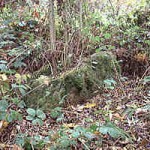 Only two small stones are left today. In 1883 G B Witts reported: “The barrow has been removed, or nearly so, leaving some of the stones which formed the chambers, especially a large one locally known as the Giant’s Stone.” By 1920 this large stone had disappeared. Take Hayhedge lane and continue along it when the tarmac stops. On the left is a small triangular pasture just before the footpath lane on the left. On the side of the pasture furthest from the footpath are the pitiful remnant of the Giant’s Stone long barrow. Invisible from the lane – visible in winter from the field side. No 11 in Old Stones of the Cotswolds.
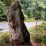 A tall pointed stone at the side of the Gloucester to Monmouth rd where tracks through the Forest of Dean meet. Tradition says that if it is pricked by a pin on the dot of midnight, it bleeds. Unlike many roadside standing stone, this escaped nineteenth century roadmakers in search of rubble.
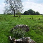
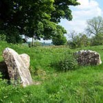 Both are south of The Camp village and in the parish of Miserden close to the road from Bisley. Camp Barrow North is identifiably a long barrow with several large slabs of the entrance of one of the chambers visible. Camp Barrow South, possibly a round barrow rather than another long barrow, is so close that I could not really distinguish between the two.
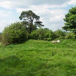 I visited in rather a hurry and the nettles were high. I will try to go back in winter when it is clearer. Not far off at SO 9300 0890 east of Honeycombe Farm, just near the road with a footpath sign, is another long barrow destroyed by the plough – now only the faintest mound is visible. Unless we pay farmers a fair price for preserving the less visible sites, the plough’s destruction will go on. IN “Archeological Handbook of the County of Gloucester” in 1883 G.B. Witts wrote: “A great number of human skeletons have at various times been dug up near the village of Camp.”
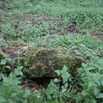
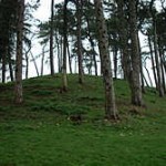 A surprisingly high long barrow made into a landscape feature by Scots pines planted on it in l890, just off a footpath. Planting up barrow protects from the plough, even tree roots destroy the barrow features. The area is still called Barrow piece. At the east end, which was excavated before l779, a flat stone is all that is visible now. In “Archeological Handbook of the county of Gloucester” of 1883 G.B. Witts wrotethat the early excavator “uncovered a cromlech in which was found a skeleton and several article of which no satisfactory account can now obtained.
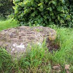 This originally stood at SP 1734 2565 about 200 yards from the church and was known as the Whistle stone. The folk lore tale was “When the Whistlestone hears Stow clock (a mile off) strike 12, it goes down to Lady-well (and the hill’s foot) to drink.” It was said that it could not be moved by human hand. When a farmer proved this wrong, the stone was given safe harbour in the vicarage paddock by the Rev. David Royce. Now it stands near the village hall with a little notice. Without the help of the vicar, it would probably have been broken up to make roads or a local rockery.
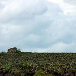 In the middle of a ploughed field about half a mile from the Whittlestone. Not far from the Lower Swell long barrow and the two long barrows in Upper Swell. There is no sign of a long barrow mound so this is said to be just a megalith with no prehistoric interest. Local tradition says a farmer tried to move it, but he found it went eight feet into the ground and the pulling tackle broke.
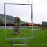 This is in all probability the very stone that gave its name to the Teobaldestan hundred and marked the meeting place of this Anglo Saxon administration unit of one hundred hides. Marking boundaries with standing stones (existing prehistoric ones or ones placed there) was common Anglo Saxon practice. They are often found as boundary features near tracks and roads. Other Saxon boundary markers were ditches, large trees or trees with crucifixes on them, streams, pools, and prehistoric burial mounds. In a world without maps, it was necessary to orientate by visible features on the ground. The Tibblestone looks as if it has been shaped. It was discovered under the soil in l948 by Mr C. J. Lucy the then owner of Teddington Cross garage. Now it’s been placed on the garage lawn and is surrounded by more modern and less durable road signs. It looks odd there but, as it owes its resurrection to the garage, why not! Folklore says the stone landed here when a giant that lived on Dixton Hill was throwing rocks at the ships in the Severn seven miles away. This particular stone fell short, because he lost his footing on the side of the hill.
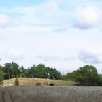
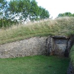 For once excavation was not destruction. This long barrow was reconstructed by the Ministry of Work in l929 – thus leaving us a notable monument. The horned entrance is a false façade without any tomb though with deposited bones of a young man and five children (possibly later). There are tombs at the far end and either side, both the latter having obstruction stones. The parish boundary of Winchcombe runs next to this long barrow. For the most enjoyment walk from Cleeve Common, through the summer butterflies, towards the long barrow which is visible far off. The other approach from the steep wooded escarpment is less enjoyable but more authentic since the long barrow, just down from the top of the escarpment was probably originally in woodland.
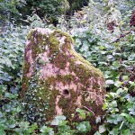 At this stone was held the hundred court of the Anglo Saxons, a moot or meeting place. The stone may have preceded it by thousands of years since the Saxons often took existing standing stones and barrow as boundary marks (see the Tibblestone). It is not far from Dover’s Hill, the place where the first ever English Olimpicks were held from 1612 (see my book section for an account of these games). Park at Dover Hill and walk to Kingcomb crossroads. Turn right round the edge of Weston park wood. Ignore the gate leading to Weston Park farm and walk onwards towards the till you see a gap in the hedge on your right and this small stone. It has been holed at some point in its history.
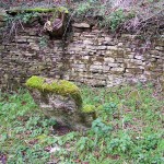 A 13th century copy of an Anglo-Saxon charter of King Athelstan, dated 931, giving land to Malmesbury Abbey, mentions “la hore stone,” as one of the boundaries. This stone was probably at SP 000 003 where the parish boundary moves away from the Foss Way – according to Saxon Charters of Gloucestershire by G.B. Grundy, 1935. It is no longer visible.
But John Yonge Akerman, writing in l856, identified the hoar stone as the mounting stone that stands a few feet away from what was originally the Thames Head spring (now re-sited with a modern marking stone the other side of the Fosse Way in a little dell). This, known locally as Athelstan’s stone, is at ST 985 991.
Akerman wrote: “It has been adapted to the purposes of a horse-block of “upping stock.”” Three steps are cut into it. One theory was that this stone was a Roman milestone, though its flat top makes this unlikely unless it was reshaped. Compare it with the Fretherne Roman milestone (below) with its round top.
For years the mounting stone disappeared under a great heap of brambles and on three different visits I was unable to find it. But now thanks to parish councillor Glen Moreman, and a friendly landowner, it is now visible again. It looks rather more battered than it did in JY Akerman’s sketch. Akerman describes it as just outside the limits of the Fosse Way, but its present site below road level may mean it has been moved for road improvements. Compare this stone with the Mounting stone now in Trellech village (see Wales, Gwent).
Somewhere at the parish boundary should be the Zunt stone, also mentioned in the charter (“ab illo loco usque zunte stone”). Grundy places this at SU 011 986 but there is no site of it now. Akerman claims to have found it fallen by the wayside at ST 969 976, the other end of the parish boundary. He wrote: “I have reason to believe it will soon be restored to its former resting place” which was “Kemble head” (now part of Kemble airfield).
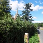 This shaped stone is considered a Roman milestone by the Milestone Society. It is sited just before the church on an old route which may have led to a crossing of the Severn – though later crossings were probably at Upper Framilode. This website is mainly devoted to prehistoric standing stones but I have put this in for comparison with the Kemble hoar stone and the Crow Hill stone in Herefordshire.
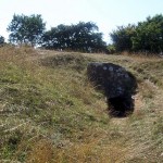
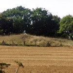 Named after the seventeenth century landowner’s wife, this is a long barrow, which has been rebuilt though not very expertly. It is just a little way away from Nympsfield long barrow which wasn’t reconstructed but instead left open. The tomb was discovered in 1820 when the beech trees were cut down and excavated in the following year. The mound was edged by drystone walling and is dated before 3000 BC.
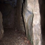 There were 15 skeletons and the jaws of several wild boars in the chambers, in the gallery and just outside the entrance, according to Helen O Neill writing in 1961, but G. B. Witt in his Archeological Handbook of the County of Gloucester in 1883 reports that there were nearly 30 skeletons. A Romano-British skeleton had been buried in the mound in later centuries. Uley Iron Age camp is very close.
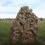 A single standing stone with a smaller one built into a wall nearby. Possibly the big one is the blocking stone to a ploughed out long barrow – rather like the Oxfordshire Lineham barrow stone. There is no sign of a mound any more. The holes in the oolite stone give rise to a standard folklore story – that sick babies would be cured if they were passed through the hole. The other legend is that the Long Stone runs round the field or goes down to the spring a Minchinhampton to drink at midnight.
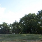
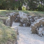 A Neolithic long barrow just below the edge of the hill, not far from Hetty Pegler’s Tump, with a third one, less accessible, a bit further on. It was examined in l862. “A chambered tumulus, which had been discovered a short time before in a partially ploughed field at Nympsfield, Gloucestershire, was opened in August last under the superintendence of some members of the Cotteswold Naturalists’ Club. A great number of bones of both sexes were strewn around indicating that the tumulus was the burying vault of some family or tribe, and not, as was at first suspected the sepulchre of heroes,” reported the Gentleman’s Magazine in l862, Part 11 p 529. There were 34 femora, a skull, some jawbones. Unlike Hetty Peggler’s Tump the barrow has been left open, rather than rebuilt but the nearby notice shows the entrance area with typical long barrow “horns” either side of the entrance and the huge size of the mound as a whole compared to the small burial area. The back part of the tomb is now missing. Not far in woodland on the edge of the escarpment is the Soldier’s Grave, a simpler Neolithic burial tomb.
Another Anglo Saxon boundary stone like the Tibblestone and the Kiftsgate stone. Originally at the boundary of the three hundreds, Berkeley, Langley and Swyneshead, the stone went missing. It was rediscovered during road widening and re-erected here not far from its original place. Probably prehistoric in origin.